Silverthorne was our best chance since Boulder to catch up on things like laundry, repacking the disorganized disaster inside our truck, and communicating with friends back home. It’s the kind of small city that exists to be a supply base for the ski crowd in the winter, and hikers and explorers in the summer.
Driving deeper into the mountains, we were reminded that not all of Colorado is picturesque scenery. The Climax Molybdemum Mine dominated our vistas for several miles. We saw miles of denuded landscape where it looked like entire mountains were being fed to processing plants. What’s left behind is barren dirt (we can’t call it “soil”) and several square miles of toxic tailings ponds, bathed in disturbing colors that don’t fit with the natural world.
We crossed Fremont Pass at almost 12,000 feet and passed through the town of Leadville, the highest incorporated city in the United States (elevation over 10,000 feet). This was a town that was built around mining instead of tourism, and it felt much more “down-market” relative to Silverthorne.
We started getting disgusted with the two types of people that populate most of Colorado: yuppies and rednecks. The yuppies run around with an overblown sense of entitlement to every desirable asset, from parking spaces to real estate; and they regard anyone wearing bib overalls or driving an old vehicle as Not Worthy. The rednecks project anger via the gravel flung from their wheels and the black smoke billowing from their tailpipes. Fortunately, we’ve been able to avoid unpleasant interactions with either group.
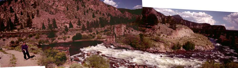
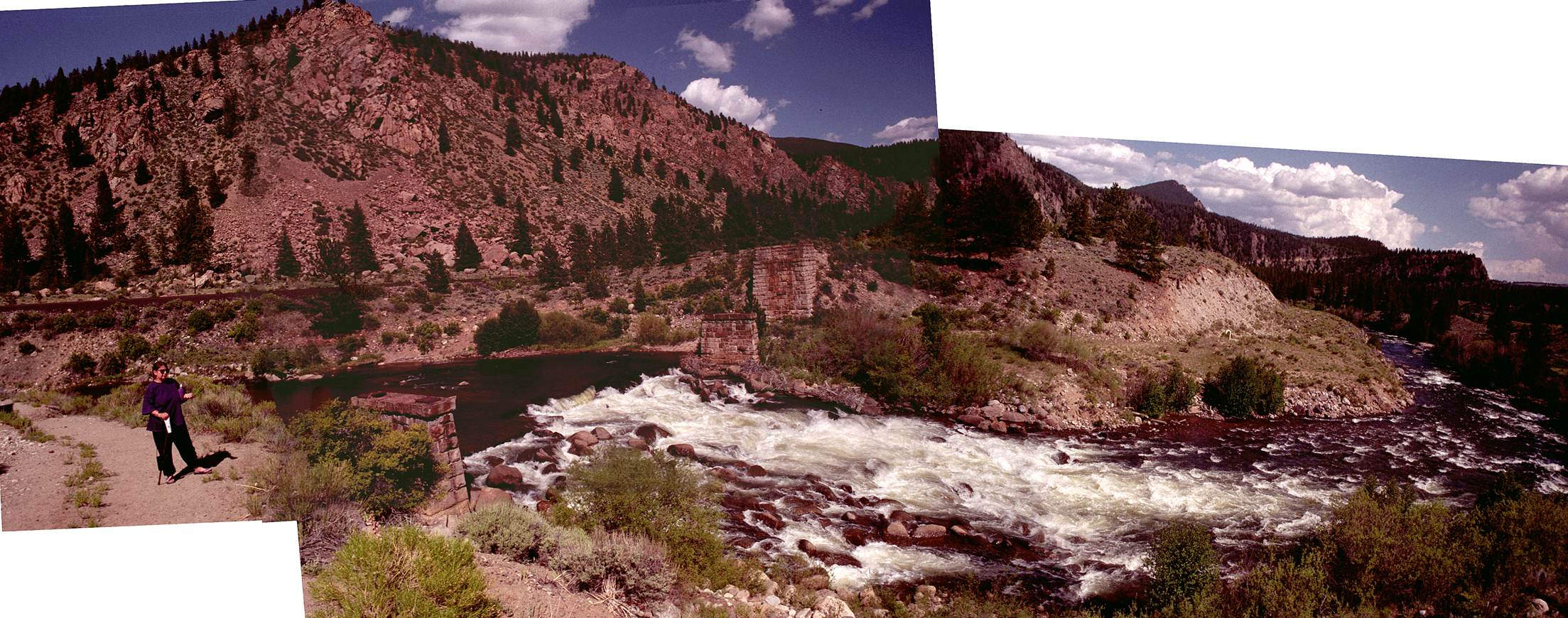
Leadville is on the eastern slope and near the source of the Arkansas River. South of town we found a place where there had once been a bridge and maybe a dam. We tried to get a broad view of the place with a composite photograph, and noticed that from that spot you could identify at least five road beds.. old wagon trails, what’s left of a railroad bridge, and the current highway and railroad.
-
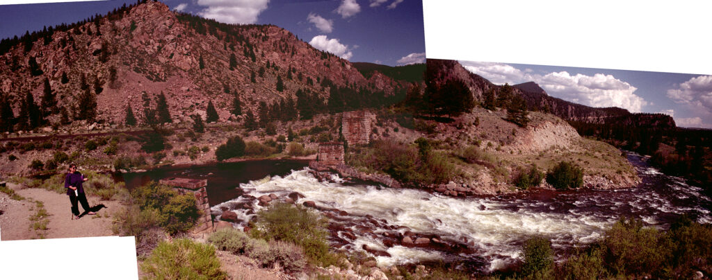
- A multitude of road beds can be recognized from this spot along the Arkansas River south of Leadville.
The river carves a canyon between here and Colorado Springs, and from there it crosses the plains and becomes the major river of the state that bears its name. We followed the valley south for a while until we reached the crossroads town of Poncha Springs, where we took a hard right turn and crossed the Continental Divide one more time, leaving us on the western slope for the foreseeable future.
We got to Gunnison before it got dark and found a KOA campground where we rented a cabin… We don’t need to set up our tent, but it’s not a motel room either… something in between.